After meeting up at Nanakuli McDonald's at 8:30am, we shoved off from Kaukama Rd and began the upward grind up the north side of Kai. Huffing and puffing our way up, we sooned gained the crest of the ridge that heads up to a set of pillboxes (five pillboxes). To our right, cars purred about on Farrington Hwy. Looking northward, we noticed a great deal of house development that flanks the north side of Kai and Uka. There was even one subdivision that was under construction, adding to the sad fact that urban development is ever encroaching in our valleys.
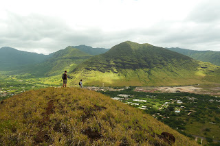
We soon reached the first of the five pillboxes and it's here where it provides the best view. Looking outward towards the ocean, this view reminded me of the Makapu'u - Tom-Tom route. It's the only other view on the island where one is so high off sea level and the shore is so close to the base of the mountain where one is standing atop. Looking eastward, we could see the entire Wai`anae mountain range with it's wall like appearance, similiar to the view from the Lanikai Pillboxes and the Ko'olau wall as the backdrop. The large expanse of Lualualei Valley dominated the landscape to the northeast. I couldn't help but think that back in the days prior to the attack on Pearl Harbor, that this island was the most heavily fortified in the world. It sure explains the sheer amount of pillboxes that dot the entire island.
Upon reaching the 4th and 5th bunker, Gene pointed out a metal pole, which served as a mount for the 30mm caliber. The 5th bunker itself was different from the other four as it had a hatch like type of entry from the roof. Again, I stopped and thought about the day of the attack on Pearl Harbor. The fact that the wave of Japanese Zeroes flew through Kolekole Pass had me thinking whether if this gun ever returned fire after the crew realized that it was an attack and not a drill. Being a World War 2 history buff, this thought intrigued me! The view to the south revealed the Kahe Power Plant and the Ko Olina Resort beyond it. Sometimes 3,000ft high mountains are not required to have such a marvelous view!
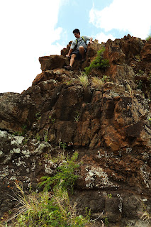
Beyond the pillboxes began a slow descent to a low lying saddle that has a water tank on the Nanakuli side. There was some nice rock formations that provided some fun for the rock scramblers, although most of these formations can be easily contoured. We also encountered a puka. At the bottom of the saddle was where Leslie would disembark from our group as he had an appointment at around lunch time. The rest of us would continue on to the smaller summit of Uka. The climb was gradual and before we knew it, we were at the very broad and flat summit. Looking back towards Kai and the saddle, we could make out Leslie descending towards the new Maili community housing area. The view from Uka is not as impressive compared to Kai. One thing was distinct and that was Pu'u Heleakala, directly ahead of us to the east. In between Uka and Heleakala was a paved road that we would descend to. The descent was uneventful, but near the bottom is a rope section on a somewhat tricky rock face.
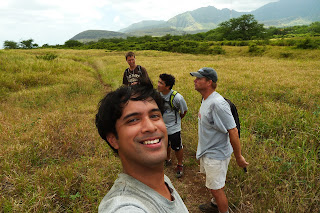
We reached the paved road after a 3 and a half leisurely stroll. For you speed hiking demons, this can easily be completed in 2 hours or less. Be prepared with sunscreen and ample water if the clouds are not present.
Video:


No comments:
Post a Comment