Head north--- Thru hiking the Ko'olaus? ---Head south
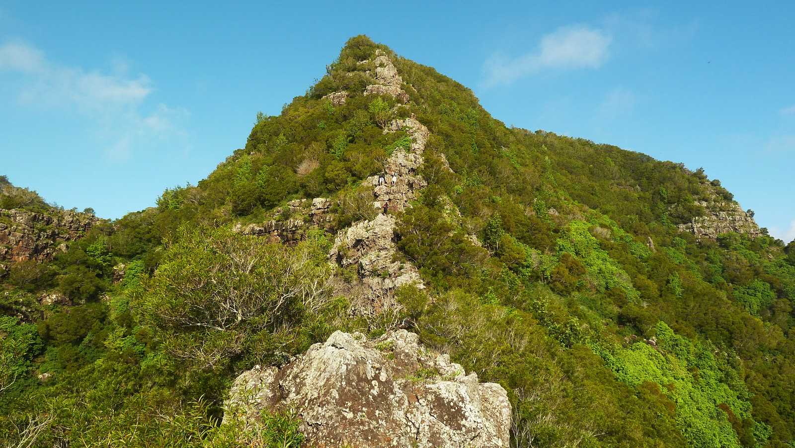
The last time I've hiked to the Pali Notches was back in July of last year with Ian. We only went as far as the nub just before the suicidal wall, "Chimney", and the rest of the ridge that heads up to the tallest peak of the Ko'olaus, Konahuanui. This ridge starts at the Nu'uanu Pali Lookout and comprises the east, southeast portion of the Nu'uanu saddle, one out of three "highway" (H-3/Moanalua, Likelike/Kalihi, and Pali/Nu'uanu) saddles that feature some of the most nerve wrecking hikes on the island. Last month, Pete Clines, Laredo Murray, and Duc Ong successfully climbed up Pali Notches to Konahuanui and descended Piliwale Ridge, all in one hike!
There's been speculation about the use of the 2 notches that sit high above the Pali Lookout with a commanding view of Nu'uanu Valley. During the battle of Nu'uanu, King Kalanikupule and his remaining defenders of Oahu were driven back to their last stand at the Pali Lookout. They fought a vicious battle for survival against the overwhelming army of King Kamehameha. Kalanikupule had his troops ascend the ridgeline leading up to Konahuanui to dig two notches on a flat section of the ridge. Whether if these notches were already natural or carved out by the army remains a mystery. There is also debate whether if cannons were installed in each notch or if they served as sentry posts for scouts who directed cannon fire. Either way, Kamehameha sent up his best troops up Konahuanui from Tantalus and descended the "Pali Notches Ridge" to sack the cannon crew and or sentry men. It was reported that Kamehameha was listening for the silence of the guns and that once they were, he knew his men succeeded.
On this day, five other people (Chenay Borja "HC GMa", Marcus Griego, Howard N. Uyeda Jr., Chris Maria, and Michael Loftin) were daring enough to join me to relive that historic feat, except we would be doing it in reverse! Our goal: summit Konahuanui K1, via the ridgeline consisting of the Pali Notches, and then descend the Konahuanui Trail to Pauoa Flats. From there we would exit via the Manoa Falls Trail. The weather was absolutely perfect, a cloudless Ko'olau spine as far as the eye can see. Winds were calm and there was slight haze due to the vog.
Marcus picked me up at Ewa Beach and we met HC GMa at the end of Manoa Rd (residential area) at around 6:30am. Once we staged a car there, we headed on over to the Pali Lookout to meet with the rest of the crew. Howard would also stage his truck at Manoa Rd as well. I also got the opportunity to meet Howard's friend, Chris.
We pushed off a little after 7, making our steep climb to the Pali Notches. The Lost Trailblazers, another extreme hiking group, scouted the wall and chimney about three weeks ago and from their write up, ropes were present on the 2nd notch. I regret to report that these ropes are no longer there. With the massive climb ahead of us beyond the notches, we expected to get through both notches with ease. Without the ropes, we had an extra problem to deal with. Unfortunately for me, I had the same problem I had last year and had to rely on the tallest person (Ian last year and Chris this year) to stand at the base of the 2nd notch, facing the wall. Once I was about halfway down, I placed my feet on Chris's shoulders and he assisted in lowering me down safely. 2nd Notch - 2, Me - 0
Once past the 2nd notch, we hiked a flat section of the ridge until we got to the nub. That wall was just as terrifying looking as last year. Once in the small saddle between the nub and the wall, we began our preparations for our vertical ascent. Looking upwards, we could make out a long knotted rope and another rope that was wrapped around two metal stakes to act as some kind of guide. We decided to ascend barefeet, as it surprisingly provides extra traction to the sometimes moist rock. Chris was up first, followed by GMa and Howard. I was up next and I started up it's left side. Once at the metal stakes, I followed the rope upward and crossed over to the right side of the wall where I grabbed the knotted rope. With both ropes in my hands, I heaved myself upward to the "Chimney", where one is sandwiched between two massive featureless slabs of rock. There are absolutely no foot/hand/elbow/head holds whatsoever. The two slabs of rock are so smooth, they might as well be two slabs of ice! With only two ropes acting as my life support, I jammed my knee between the 2 rocks and was about to use my back as a means of friction when I realized that my pack was still on me. Darn. I called up to Howard to see if I could throw my pack to him. Once he was in position, still hanging on to the rope with my left hand, I slid my hand under my pack and took it off my back. I hurled it up as hard as I could, landing to a spot where it was within reach of Howard. He grabbed it and tossed it aside as I somehow shimmied upwards and made it to a "flat" ledge separating the walls below and above us. Michael Loftin was up next and he powered up it almost effortlessly and Marcus was last to reach the ledge. With the Chimney behind us at last, we all breathed a sign of relief, not knowing what was ahead of us. I proceeded to put my shoes back on.
Continuing our steep climb upward, we encountered a dead branch with an old looking white cloth or something that was wrapped around it. Beyond that was our next problem, a concaving rockface that was occupying just about the entire width of an already narrow ridge. The windward side of the face was nearly impossible to climb and the townside had an almost non existant ledge that contours around it to the right. Chris scouted the town facing side but was spooked by the death drop. Howard who was next, assisted him as he climbed directly up and over the face. After a lot of this and that, Chris somehow made it over and Howard contoured over to the townside facing side and climbed it. He affixed a rope for the rest of us to climb. GMa was next with the contour and as usual, made it look all too easy. I was next and at first could not make any head way. It was then I decided to try it barefeet again and was able to make it to the rope and climbed up without incident. Marcus and Michael followed. Howard then uninstalled the rope that he installed just in case we needed it further upridge.
With that obstacle out of the way, we climbed upwards, the ridge easing off slightly. It transitioned from a rocky wall like appearance to a more green and overgrown ridge, typical of Ko'olau summit ridge walking. We eventually reached a nice clearing where we took a break. We gazed out at the windward expanse, albeit some vog. There wasn't any clouds except some cirrus clouds, indicating an approaching cold front. With the sun beaming down on us and the near absence of wind, it made for a hot and sweaty break.
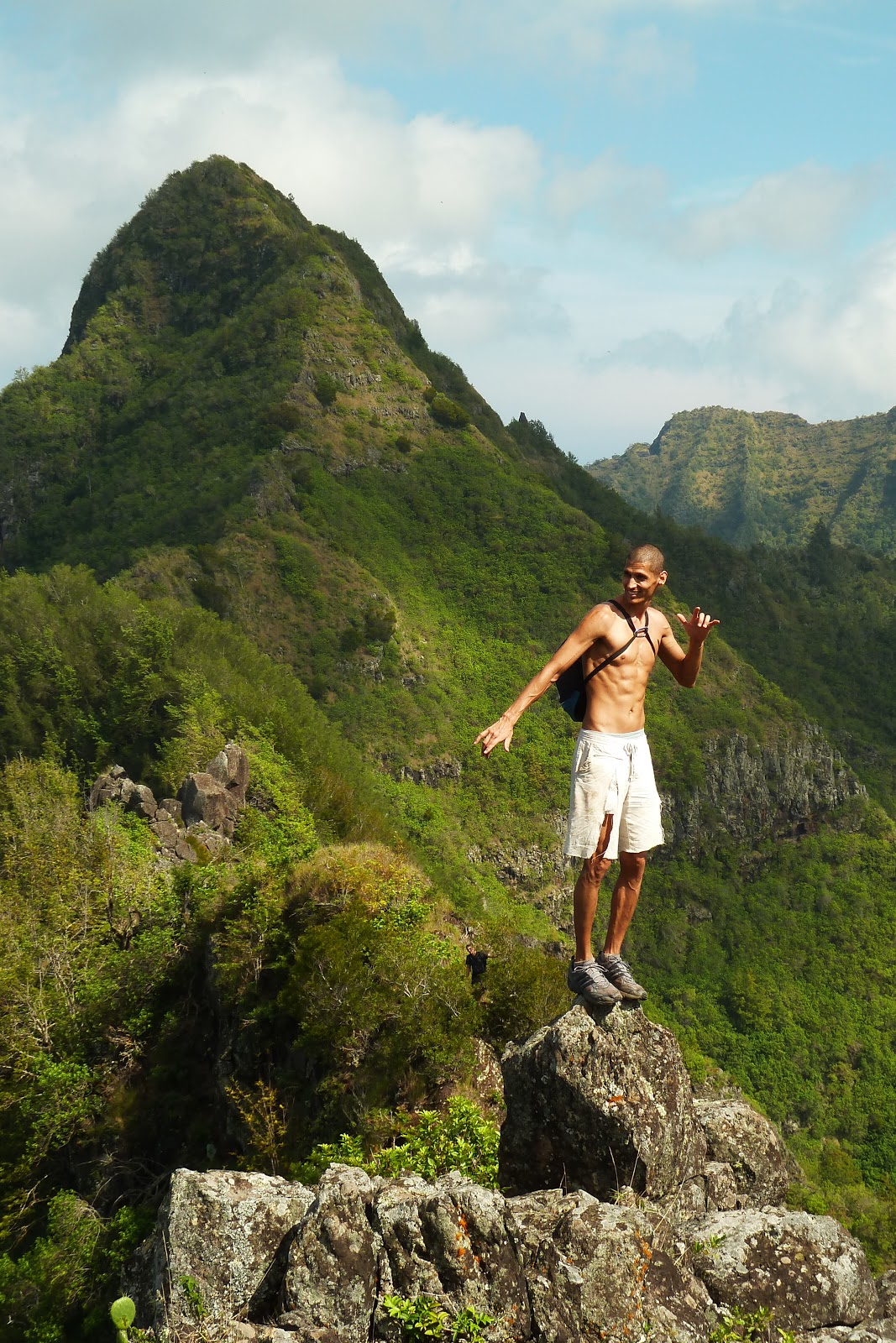
Marching on, we climbed a small knob and I noticed a side ridge coming in from around the area near the Pali hairpin turn. I remember Pete Clines mentioning attempting but unsuccessfully climbing "Konahuanui Windward" because the last few hundred feet or so was simply too steep. I gazed at the grade of the ridge and I concur! From our vantage point we could make out the remaining ridgeline leading up to K1. The ridge narrows considerably, but never to True Manamana proportions, however there are two spots along it where it may slow one's progress. There is a good sized boulder that occupys the entire width of the ridge and another almost vertical climb to gain a good sized knob. There's a tree that helps you with the bottom most portion of the climb. Beyond those two, the summit is easily within reach. The adjacent windward ridge to the left, which eventually intersects the ridge we are on further near the summit, is the infamous Piliwale Ridge. Sure enough, some 50ft vertical feet before the summit was a junction with a trail leading off to the left and then disappearing into the depths below. This junction was the topping out point of Piliwale Ridge.
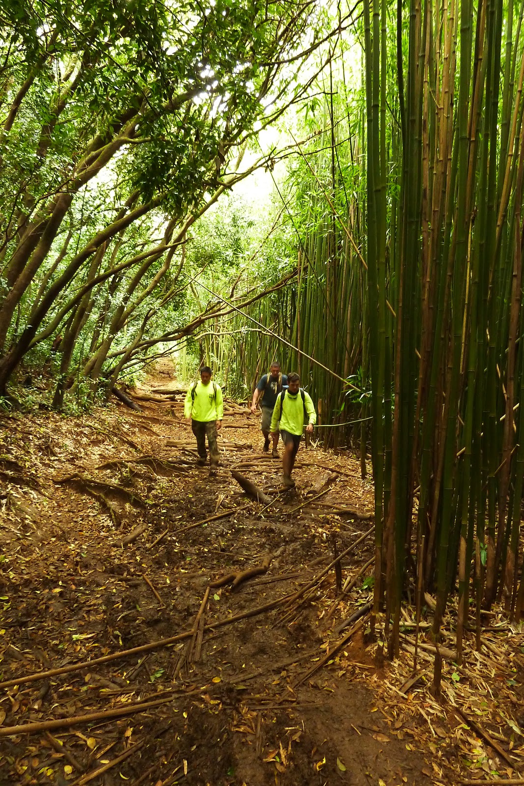
We topped out at K1 summit at approximately 12:20pm and after a short break, crossed over to K2 and proceeded down the Konahuanui Trail. As we descended, I pointed out a clearing where I spent the night last July during my hike on Piliwale Ridge. We then reached the Puaoa Flats lookout at 3pm and made our way down the Aihualama switchbacks to Manoa Falls. After a refreshing rinse, we exited via Manoa Falls Trail and were at the cars a little after 4pm to conclude our wild adventure!
(5-23-2011 Note: Recently, hikers wanting to descend the Pali Notches ridge and Piliwale from Konahuanui K1 have been getting disoriented with this junction, especially when it's socked in with clouds. If starting your descent from K1, you will come upon this junction. Taking the trail to the right heads down Piliwale Ridge to Maunawili Demo Trail while the left trail takes you down the Pali Notches ridge, which terminates at the Pali Lookout.
WARNING: BOTH routes are very dangerous with very steep grades and crumbly rock. Make sure to test all ropes!)


Video: