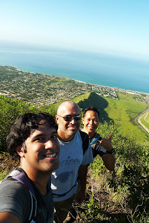
I've enlisted the same crew who did the `Ohikilolo Rectangle with me prior to this hike: Marcus Griego and Eddie Pieters. While Marc and I decided to "suit up" and wear long pants for the dreadful tread through the overgrowth, Eddie braved it out with shorts the whole way! We all met at my house in Ewa Beach and carpooled to Nanakuli McDonalds for a 7:30am start time.
We walked down Naval Rd. for a short distance before veering off to the right and followed the fenceline of the nearby Nanakuli residence, making our way towards the ridgeline (There is actually a trail further mauka that also heads to the same ridge). We passed by a pillbox during our short climb and we were soon on the crest. I had several flashbacks of the July 18, 2009 hike up Kamaile'unu Ridge and how extremely hot that day was. I hope we wouldn't have a repeat of that hellish excursion.
The jaunt up Pu'u Heleakala was rather uneventful and the three of us were talking stories to pass the time. At about the same time, we got the first gleaming rays of the morning sun. I couldn't help but think about the legend behind this peak. Heleakala means “where the sun is snared” or “where the sun’s rays are broken”. According to Wai`anae folklore, the summit of Pu'u Heleakala was the site where this legendary feat took place. Apparently there are some "conflicting" beliefs whether if Maui, a demigod, snared the sun at the summit of Haleakala ("house of the sun") on the island of Maui or on the Wai`anae coast of O`ahu at the top of Pu'u Heleakala. According to Wai`anae tradition, Maui's mother was unable to dry her kapa clothes because the sun moved across the sky too fast. Maui then managed to lasso the rays of the sun with his magic from the summit of Heleakala and demanded it slow down it's pace. The sun agreed and up to this day, the sun slowed it's pace. If this were the case, then the sun broke it's promise every winter when the days are shorter!
We topped out at Heleakala, "marked" by an abandoned tent, and we could see see the ridgeline continue it's way up to Palikea. We got curious of a side trail that led off into the brushes. Upon reaching it's end, we came across what appeared to be a heiau. Not wanting to disturb the tranquility of the heiau, we kept our visit to a minimal as we quickly gazed out at the commanding view of Lualualei Valley and Pu'u O Hulu.
Beyond Heleakala, the ridge heads down into a low lying saddle which Wing Ng labels as "Despair Dip". I would agree with him upon reaching the other side of the dip! The California grass was thick but still manageable. We climbed a series of small rockfaces which were nicely arranged into a pyramid style type of formation. Looking back, we could see the massive Pu'u of Heleakala and the smooth expanse of Nanakuli Valley and the massive expanse of Lualualei Valley, dotted with roads and other military structures that were in a uniformed pattern. I remember Eddie mentioning that some of them looked like crop circles and that aliens have landed! Maybe he's right...
After the dip, the ridge begins a series of ups and downs and traverses a rocky dike or two. We reached the last hump and we could see Palikea dead ahead. "Ahh, this shouldn't be that bad. It's just one small saddle and then the final climb to Palikea, right?"
Wrong!
Once at the bottom of the saddle, the overgrowth thickened exponentially, those small Koa trees with "explosive in every direction" branches returned, and the "path" disappeared into oblivion. By this point, the intense sun was getting to me, although there were more scattered clouds floating about near the Wai`anae crest and this helped with providing some temporary shade. Every now and then, we received a gentle east wind. Somewhere along this point I lost sight of Marcus, who was the ramrod on this day, in the soup of dry foliage. Because there is absolutely no path whatsoever to follow, I thought Marc contoured to the left of some thick brushes. Apparently when I heard his voice, we were too far below and had to climb back up to the crest, an unncessary waste of energy.
We eventually came across a rock formation that was shaped like a mushroom, akin to the mushroom rock on Bear Claw. Unfortunately, we would also discover more similiarities to Bear Claw as we neared the summit.
Continuing on, everything was just a mess around us. We virtually had to find the route of least resistance. After traversing some narrow rock dikes, we could see that our first major obstacle was looming ahead. The "path" eventually went on the Nanakuli side of this obstacle and it was here where we would attack our first major rock face. Eddie, being the lightest out of all us was first to climb and secured a rope. I was up second, followed by Marc. Immediately beyond was yet another rockface. This one was full of handholds and footholds but nearly every one of them was on loose rock. Another problem was the choke full of tree branches directly behind us. There was hardly any space between the two. This has a new meaning for "Between a rock and scratchy branches"! Eddie had the advantage at being the smallest guy in our group and assumed the ramrod position. He was able to rocket up these rockfaces with the least resistance from surrounding tree branches.
If it's not rock faces to scale, it's a very steep slope on dreadful Buffalo grass. It probably goes something like this: "Rock face, grass, rock face, grass, rock face, grass..." When the steepness of the ridge did finally ease off, we entered a forest boundary and the grass was gone for good. Finally some relief! I have to call that entire section starting with the very first major rock face up to the forest a "Bear Claw and a half".
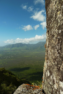
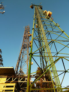
We eventually came across a small clearing with some low lying uluhe (our first uluhe of the day!) and could make out the entire Wai`anae summit crest from Pu'u Kaua to our left, and the Nanakuli Forest Reserve to our right with some radio/cell phone towers to add to the mix. Just one more small climb and we are there! Fortunately, the climb was minor and we came across a fence (not again) and hopped it. Beyond it was the magnificent view of the Wahiawa Plains, Pearl Harbor, and the Ko'olau Range. Behind us was the view of Pu'u Kaua, flat topped Ka'ala, and Kamaile'unu Ridge, all lit up golden orange as the sun was very low to our west. The time was nearly 4:30pm. We made it at last! It took us roughly 8 hours just to reach the summit of Palikea.
We followed along the fenceline to our right from the summit and started our way down the Palehua Trail via stairs. I was never so relieved to see stairs after what we went through earlier today. In fact, I was very impressed with the sheer beauty of this trail. It's one of the best maintained on the island for sure. The trail meandered it's way along the crest of the Wai`anae summit, contouring rather than following the crest. We passed a rock tunnel and then a bamboo grove. The trail eventually ends at a radio tower and our longest road walk ever on Palehua Rd towards Makakilo began. Along the road were private houses in a setting similiar to Tantalus Rd. What was even more intriguing was that every "household" was assigned a letter on a yellow sign. We were at the letter "S" and I assumed the road would end at the letter "A". Oh dear... we have a very long way to go. It was getting dark and out came our flashlights. Soon a car came zooming up and hit the brakes hard, it's driver probably startled to see hikers coming down the road. "Ahh, too bad he wasn't going down towards Makakilo!" A short while later, a forest ranger in a truck came up the road and stopped along side of us, informing that we were trespassing and told us to climb into the back of his truck. Apparently, the car that passed by us earlier called the forest ranger upon seeing us. We passed by Camp Timberline and could make out the city lights of Makakilo.
After being ejected (an egress for us!) to Makakilo, the ranger identified himself as Thomas Anuheali`i, the caretaker of Palehua. He was shocked after learning where we had started and gave us props for doing such an enduring task. He told us he explored this spur from a top down approach, stopping just before the ridge starts it's steep descent. He gave me his contact information and explained how to get access to Palehua Trail. Apparently you need to deposit $100 for a key (you get it back upon return of the key) that opens one out of two gates. The other gate is a combo lock. I would love to go back to Palihua Trail again someday! It's a very easy novice trail to Palikea, while at the same time, offers beautiful vistas of the leeward coast!
If I ever go back to Heleakala, I will definitely come back with a machete. Randy Glidden, who did both left and right forks of Bear Claw Ridge with me, has plans of returning to open a trail up to the base of Palikea. I just might very well join him!
Video:


Great write up Dave!! It was a great hike. Thanks for leading us!!
ReplyDeleteI heard Laborda hosakana is found only in the Ko'olau mountains and usually on the windswept windward side. This plant was in various stages of reproduction.I hope I could go their when we hike this summer.
ReplyDeleteSedona AZ dining