Friday, March 14, 2014

11-8-2013: Waiʻanae Summit Trail - Kealia to Mt. Kaʻala Rd.

CAUTION: The Waiʻanae Mountain Range is located on properties owned by the U.S. government, the U.S. military of all branches, the state of Hawaiʻi via departments, and private owners. The mountain ridges and valleys are also home to a delicate and vast array of native plants, animals, and insects. Please take care not to disturb them or their native habitats and always seek permission to access these lands. Always do your research prior to setting out. And finally, once you are out there, always minimize your impact to the environment and of course, be safe.

Today's adventure covered the section of the Waiʻanae Summit Ridge between the terminus of Kealia Trail and Mt. Kaʻala Road.  We had hoped to gain the actual summit of Mt. Kaʻala but time caused us to head down the very long paved road back to Waialua.  Joining me on this trek would be Joshua, Jon, and Jani.  This would be Josh's first hike out in the Waiʻanae Mountains.  We didn't have a car staged because of our plans to reach Kaʻala and head down the Waiʻanae-Kaʻala Trail down into Waiʻanae Valley.  That trailhead is notorious for break ins so we opted for a pick up at that location.


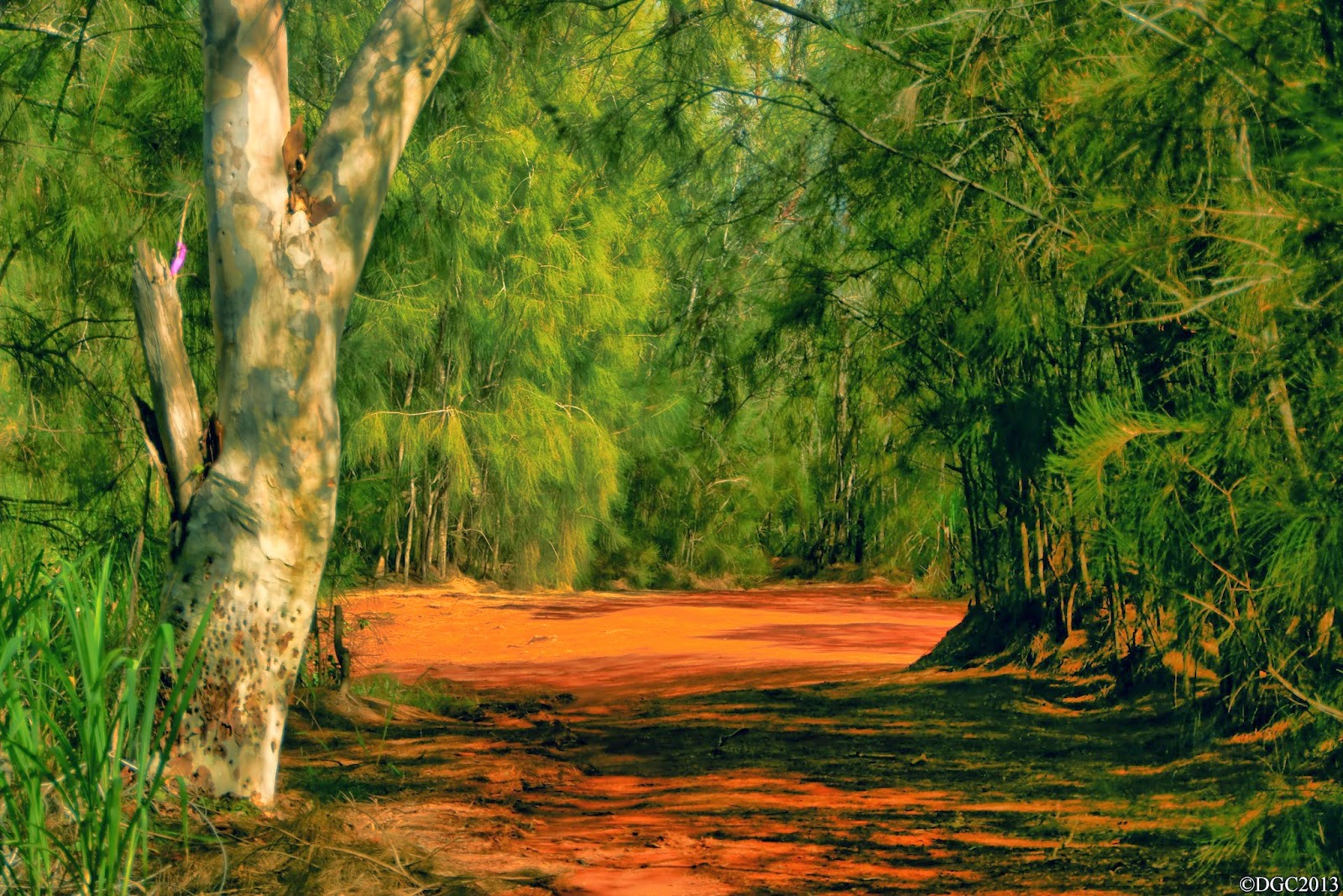
We started off at around 8am at Dillingham Airfield and headed up Na Ala Hele's Kealia Trail.  The last time I did this actual trail was back in 2008.  I recalled the steep "Three Sisters" as one blogger called them, a series of uphill dirt roads.  It wasn't as taxing as it was back in 08 and we soon gained the Kuaokala Hunting grounds.  We passed a junction that had a sign, indicating the direction of Kaʻena Point Satellite Tracking Station, the U.S.A.F. military installation that I've visited a week ago.  A short walk through Ironwood forest and we were looking down into Mākua Valley, one of many leeward valleys of west Oʻahu.  Looking west along the crest, we spotted a group of hikers.  They were appearing to head in this general direction, possibly from KPSTS.  The weather was excellent for summit walking, clear of clouds with gentle breezes.


We didn't waste time at the top as we had a long day ahead of us.  After exchanging shakas with the other hiking group, we headed eastward along the crest.  Looking at the vista, we could make out the summit ridge heading all the way to the mammoth Mt. Kaʻala.  Puʻu ʻOhikilolo was clearly visible as the pyramid looking peak and it's ridgeline spanning from the summit crest all the way to Keawaula Bay (Yokohama Beach).  We thought we were going to be hiking the crest for the entire way, but it wasn't long before we found ourselves on one of the dirt roads that makes up the complex dirt road system in this area of the Waiʻanaes.  As we continued to hike east, the angle that we saw Mākua Valley changed.  It opened up to a larger viewing area of the valley and the ocean.  There were times that we also got some spectacular views of Oʻahu's north shore.  The HECO (Hawaiian Electric Co.) Pūpūkea wind farm, which was erected in 2012/13 created an eye sore as I remember this view vividly without the windmills.  The northern Koʻolaus were clear of clouds but we could see the cumulus clouds forming over the mountain range.


We eventually came upon that metal fence line that I've always dreaded while hiking.  Since this fence separated the leeward from the windward of wild goats or pigs, we were to follow this fence for much of the way.  Since I've also remember hiking the summit stretch of the Waiʻanaes between Peacock Flats and Three Corners years back, I knew this fence would stretch all the way to at least Three Corners.  Better learn to enjoy the fence, Kawika.


We continued to hike for some time, enjoying the ever lasting views of both north shore and Mākua Valley and the surrounding flora and fauna.  We stumbled upon a geological survey marker that read "MOKU".  A short while later, we've came upon some sort of building area and a paved road.  We didn't know what was here or if we were able to be here so we snapped a few photos and continued on our way.  There were a few wooden structures holding up steel drums.  What was inside these barrels was unknown.  The further east we went, the more central Oʻahu was visible.


I began seeing familiar areas.  Wait, was that building complex that we've passed a while ago part of Peacock Flats area?  Jon apparently told us that it was and he was right.  We were well on our way to Three Corners.  We kept following the fence and running into random signage that dotted the fence line, ranging from explosive area, to signs indicating rat poison traps, and the like.  Then suddenly the vista opened with the most incredible view of Mākua Valley I've have ever seen, although I've seen it before!  But wow, this view was still as breathtaking!  Unfortunately, clouds were beginning to form over the crest and we knew this meant trouble for navigation purposes.  We pushed onwards and the landscape changed from the dry Waiʻanae Mountain look to a more Koʻolau look with the Uluhe.


We were in autopilot with a heading of following the fence as the clouds continued to thicken around the summit ridge.  After a while, I began sensing that something wasn't right about our path.  We were heading in a mostly downward direction, something that we shouldn't be doing on the crest.  We reached a grassy flat section and I began to mention the doubtfulness of this path.  At the same time, the clouds lifted and we were looking at the north shore head on.  Somehow we got turned around with the fence line at the summit in all those clouds.  Frustration began to settle into me as I couldn't figure out how we ended up here, when in fact, I've done this section before.  Turns out even navigating in the clouds in a familiar area can still prove tricky.  We headed back up to where we came from.  Once at the top, the clouds were still thick enough that we couldn't make out the crest but we did notice that the fence did split into another direction.  This must be the summit crest.  Sure enough, the clouds lifted to reveal the answer.  I've totally forgot about the fence junctions and apparently let autopilot follow the fence.
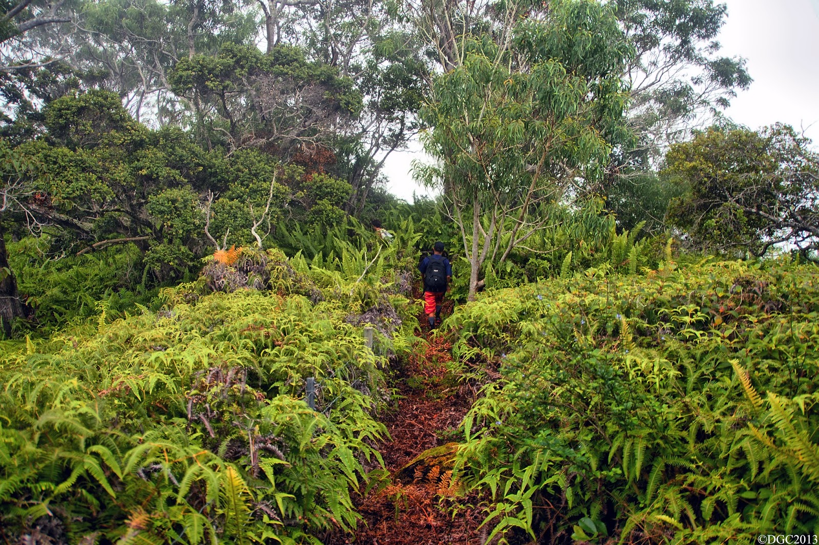


Finally, we were back on the right path and headed onward on this roller coasting ridge of a hike.  The somewhat steeper sections where the fence became the ground were annoying as hell.  Regardless, we made it to Three Corners at last, but the clouds were beating us to the view.  We witnessed the view for about a few minutes before the clouds completely shrouded it.  The sunlight was beginning to fade so Kaʻala was out of the question.  Then I thought about the paved road that lead up to the flat topped peak.  We'll just head down that instead.  The Uluhe returned and the trail was overgrown.  We got to a point where we could make out the road about 50ft below us, paralleling the ridge crest.  We noticed a faint trail heading downward to it so down we went and we all felt relieved when we set foot on pavement.  Now to head down 5 miles of it in wet misty cloudness.  Ugh!


Nevertheless, we were happy of how much we've covered on this day.  As we dropped below the cloud decks, we could make out the blinking red lights of the Pūpūkea wind farm, which made for an eerie futuristic look.  Looks like it could resemble a cloaked star ship like the Enterprise that has landed there.  After a painstaking hour or two on the road, we made it to Farrington Highway.  Mahalo to Jon's Mom for picking us up!  What an epic day in the mountains indeed.

Thursday, March 13, 2014

11-1-2013: Waiʻanae Summit Trail - Kaʻena Point to KPSTS

I want to wish all of you a Happy 4th of July, Happy Halloween, Happy Thanksgiving, Merry Christmas, Happy New Year, Happy Valentine's Day, and soon to be Happy St. Patrick's Day!  That's because the last time I've updated this was back in June of last year!  I've been just so busy with life that I couldn't even keep up with this blog.  I am also extremely behind in video documentation.  Remember the time in late 2012 to early 2013 when the lava fields were active down by Kalapana, Big Island?  I still have video footage of that event that I still have yet to release.  The year in review video for 2012 and 2013 was a bust.  Talk about wishing that there were 25 hours in a day.  Will I ever get all of these out to you?  I'll stop making promises but someday, maybe 20 years from now, I just might.  However, during this long period of absence from the blog, I was able to document Oʻahu's western mountain range, the Waiʻanae Mountain Range or the Waiʻanaes for short.  The Waiʻanaes is the older of the two ancient remnants of the two shield volcanoes that formed the island of Oʻahu.  Both have had makai (ocean) facing flanks destroyed in massive landslides.  The Koʻolau lost it's windward flanks about a million years ago and the Waiʻanae lost it's leeward flank about 3 million years ago, forming the shape of the island that we recognize today.

Just like the Koʻolaus, I wanted to document the Waiʻanaes by hiking it's entire summit ridge in segments also known as section hiking (as opposed to thru hiking).  The first segment would be the northwestern most end of the Waiʻanae Mountains from Kaʻena Point to a point on the crest that contains the Kaʻena Point Satellite Station, which is operated by the United States Air Force.  But before you continue reading this write up, please read the following paragraph as I will also include this for all the upcoming write ups of this mountain range.

CAUTION: The Waiʻanae Mountain Range is located on properties owned by the U.S. government, the U.S. military of all branches, the state of Hawaiʻi via departments, and private owners. The mountain ridges and valleys are also home to a delicate and vast array of native plants, animals, and insects. Please take care not to disturb them or their native habitats and always seek permission to access these lands. Always do your research prior to setting out. And finally, once you are out there, always minimize your impact to the environment and of course, be safe.

On this cool clear November morning, Zack, Jon, Marc, Jani, and myself began the first segment of the Waiʻanaes.  Our goal today was to hike out to Kaʻena Point, climb up the ridge line that rises up from the nature preserve which makes up the point itself, and hike along the crest of the Waiʻanae Summit Ridge to KPSTS where there are numerous large white golf ball like structure that house the U.S.A.F. tracking equipment.  One can see these structures clearly from Keawaula Bay, otherwise more commonly called Yokohama Beach or Yoks for short.  From KPSTS, we were to continue all the way to the terminus of the Kealia Trail.  This trail heads down from the summit and north towards Dillingham Airfield.  We opted to start from Mokulēia side because the Keawaula side is too sketchy to stage cars.  The hike to Kaʻena Point was a nice walk under a cool morning sun.  Upon reaching the perimeter fence and it's elevator looking gate of the nature preserve, we headed left, following the fence line until it reached it's highest point.  Here, a faint trail heads upward to a few pillboxes and marks the start of the Waiʻanae Summit Ridge.  This trail appeared to actually receive quite a bit of foot traffic, at least up to the pillboxes.  Upon reaching the first pillbox, a view of Kaʻena Point not commonly seen awaits.  The shape of the point actually resembles a bow of a cruise ship, appearing to plow forward through the bluer than blue ocean of the Pacific.  There were probably around 4 or 5 pillboxes before the trail continues upward to a fence and a few structures of some kind behind it.  It did not take long to realize that we were approaching the KPSTS.


Being a military installation, we had to engage ninja mode for this next section.  If we were to make it to Kealia Trail, we were required to traverse through this installation in it's entirely as it sits completely on the crest of the summit ridge.  It's like in those classic Nintendo or Sega Genesis video games where you have to navigate your character through a set course through a level without being spotted by cameras or an enemy guard.  If you were to get caught, you get a message "Hey!  You're not supposed to be in here!", the screen goes black, and you find your character back at the start of of the level where you have to try again and again and again to progress further in the game.  Today, there would be no reset button or going back to the start of the perimeter fence to try again and again.  If you get caught anywhere on the installation, the military police will escort you down the road and drop you off at Keawaula Beach.  Since we didn't have any cars staged there, it made things problematic for us.

When we reached the fence perimeter of the KPSTS, we followed the fence line on it's northern side.  Soon a very smooth paved road came into view and we could see it head gradually upward, following the crest.  The fence line ended and we were soon walking on this paved road, following it.  Around us were some buildings that housed antennas of some kind and a white golf ball tracking equipment.  We continued to follow up on the paved road when we saw a truck coming towards us from the other direction.  We didn't think much to make an effort to hide.  We just simply kept walking up the road, towards the truck.  The truck stopped and the driver asked what we were doing here and if we knew this was government property.  He then told us that there was a dirt road that parallels the government paved road directly on the north side.  He appeared to be a contract worker and not an MP and pretended that he didn't see us.  So we hopped a ranch looking fence and started walking on the dirt road.  We later found out that this road belonged to DLNR, or the Department of Land and Natural Resources.


We continued on this dirt road for some time and came upon a couple junctions.  We chose the path that kept us relatively closest to the paved road.  Unfortunately, the dirt road ended back onto the paved road, which we were warned not to be on.  We tried to backtrack on a few of those junctions and see if there was any headway around KPSTS but to no avail.  We had probably less than 1,000ft before we cleared KPSTS and were back on hunting grounds.  Jani decided to scout ahead on this paved road for any guard shacks and sure enough there was one.  After a few minutes, she returned, saying the guard will pretend that he didn't see us and pointed to the direction of the trail that would take us to Kealia.  Unfortunately that mean't having to continue on the paved road until we reached said trail.  Off we went and we attempted to book it faster than normal.  We came across a parking area where we spotted some people in civilian clothing.  They said they obtained permits to hike the area so that is some good tidbits to know for the future.  We didn't waste time and continued on our way east on the paved road.  We saw more golf ball structures along the way, which made for a Star Wars feel.  We came across our last bend before we made it to the other side of the installation and back into hunting grounds.  I was following Marc when I noticed Jani and Jon far behind us.  Then we heard the sirens far behind us.  DARN!  We actually didn't see the MP but we also noticed that Jani and Jon were not coming up behind us.  We knew they got caught.  Marc thought for a split second to dash into the brushes on our left but I didn't want to leave them behind.  We stood there for a couple minutes, debating our next move.  Had we just simply continued to walk, we probably would have made it to the hunting area.  Regardless, the MP came up to us in his police truck and told us to get in the truck bed to be escorted off.  Behind him was another government official in his car with Jani and Jon.  We've been caught and knew our hike had come to an end today so we complied without second thought.


When we started down the road switch backs, we were treated to a cool view of Yokohama Beach below.  I thought about filming and taking photos but decided against it.  Upon reaching the bottom, we all got off and the guards said nothing more.  We walked over to the bathroom area of the beach.  Jani and Jon told us that the government official who was driving them in his car had actually debated with the MP in letting us continue on our merry way which could explain the long delay in getting Marc and I.  That would have been nice if they did, since we were only mere feet from crossing back into hunting grounds.  Then we all realized we were at the west side when our cars were staged on Mokulēia!  That meant we had to circumnavigate around the point to get back to our cars, which meant another 5 or 6 extra miles to hike!  Well, we did it and it was actually a pretty neat coastal hike.  When we reached the start of that faint trail again that we took up this morning, I jokingly said "Let's try again!".

With our trek cut short on this day, I had to think that if I were to segment hike the Waiʻanaes, that meant having to visit KPSTS from Kealia, which will be written on a future write up.  Stay tuned!