Sunday, April 10, 2011

4-10-2011: Kamiloiki Ridge to Tom-Tom

After hiking Kaupo Cliffs to Hahaione Windward last Sunday, it was rather bothersome with the fact that I still haven't hiked the Tom-Tom Trail.  My last "attempt" to hike this route was via the Makapu'u Ridge, which was back in late 2008.  Ever since then, the trail has been long forgotten in my never ending list of hikes to do.  Tom-Tom is a windward ridge situated between the terminus of Kamiloiki and Mariner's Ridge.  When one thinks of a Ko'olau windward ridge, one imagines: steep, rock climbing, free climbing, crumbly rocks, ripping loose vegetation from their roots as a climber scrambles for a good hand hold, Piliwale Ridge, etc. etc.  If you're not an experienced climber, but yet want to see what it's like to hike up and over the Ko'olaus, Kamiloiki Ridge to Tom-Tom is an excellent choice.  This was probably the same route messengers of kings used to relay messages between Waimanalo and the area making up Hawaii Kai.  Also in the end, the Tom-Tom trailhead (Kaupo Cliffs also starts from the same trailhead) spits you out within walking distance to Kalanianaole Rd. and Keneke's, an excellent post hike venue for food and refreshments!

On this grey and gloomy day, Francis Jimenez and I decided to take a leisurely stroll up and down this route.  In fact, with all the dilly daddling we did on this hike, we ended up taking longer than we should have taken.  But hey, nothing wrong with that!  With an 8:30am shove off time at Pahua Heiau at the end of Makahuena Place, we embarked on a 2.5 mile ramble to the Ko'olau summit ridge.  We talked stories of past hikes, GoPro setups, and the like.  I recalled my last hike up this ridge being one of the hottest hikes I've done on the Ko'olaus as there wasn't a single cloud in the sky.  Today was the complete opposite, the sky being a rather depressing grey tone, sucking away all the vibrant colors of the surrounding landscape had the sun been shining.  While photo ops were nearly nonexistant, it made for a comfortable hike with nice cool trades.

Before we knew it, we were at the the summit ridge with a stale view of Waimanalo Town and Bay.  We took a short break and as we were about to push off westward along the summit ridge, two local wahines appeared from the brushes, huffing and puffing as they made their final strides to the summit.  This was their first time on Kamiloiki Ridge.  It's too bad that the sun wasn't shining to really reveal the colors of Waimanalo Bay.  Next time!

We said our goodbyes and off we went towards Tom-Tom.  While the sky was overcast everywhere, the clouds did not sock the summit ridge until Pu'u O Kona and Bear Claw, where the clouds shrouded and revealed repeatedly.  As we got to the bottom of the saddle between Kamiloiki and Tom-Tom, I pointed out the topping out point of KauFaux Cliffs to Francis.  Gnarly!  I like!  Farther ahead we saw 2 hikers pop out at the Tom-Tom terminus and began heading in our direction.  After a short chat, we realized they were heading towards Kamehame Ridge, the ridge that houses the hang glider launch point.  We parted ways and came across the big water chute that heads down windward.  We fooled around here for a bit with the camera, posing as if we were to slide down this giant "waterslide".  Finally we made our last climb to the junction of Tom-Tom Trail at around 12:30pm.  Down below, Waimanalo Town beckoned and I could make out the red and white building of Keneke's.  "Das our lunch down there right?" I said to Francis.  He instantly agreed as we both opted out having breakfast this morning!

At this point, I didn't know what to expect on Tom-Tom.  But many people have ascended or descended this route so I expected it to be not bad at all.  Almost immediately, there is probably the only narrow dike on this entire ridge and it's not even required.  The trail contours over on it's left and Francis took the "low road" while I opted to walk over the narrow dike.  From there, the ridge descended quickly towards the residential area below.  While the ridge is steep, it never required 4 point climbing.  I would say the Graveyard Ridge of the Pu'u Manamana Loop Trail is probably more difficult.

Down down we went and we reached one last clearing before we made the rest of the descent through Haole Koa trees and other introduced vegetation.  I wanted to point out the junction of the trail leading to Kaupo Cliffs but we were so into our conversation that I didn't realize we were already at Manawaiola St.  The time was around 1:30pm.

We walked over to Keneke's for lunch and took the #57/#23 bus back to our starting point in Hawaii Kai.  Overall, this was a great stroll!  If you are craving for Keneke's and live near the Kamiloiki Ridge Trail and don't feel like driving, give this hike a try!


Video:

Saturday, April 9, 2011

4-3-2011: Kaupo Cliffs to Hahaione Windward

A month and a half haitus from hiking can really take it's toll, especially when one hikes among some of the best climbers on the island.  That's exactly what I did on this day and boy let me tell you, these guys can haul ass.

In ancient times in Hawaii, messengers of kings would relay messages between two villages situated in Waimanalo and the area that makes up Hawaii Kai.  Tom-Tom Trail, a trail discovered in 1922 was probably an old Hawaiian Trail that was popular among these messengers.  However, during times of conflict, Kaupo Cliffs was regarded as a secret route and hence was used as an alternative.  When one looks up at Kaupo Cliffs behind Waimanalo from a distance, they look menacing and nearly impossible to climb.

I got the chance to relive the ancient times with Pete Clines, Ras August, Laredo Murray, Nate Yuen, Duc Ong, Gene Witte, and others of the Hawaiian Trail and Mountain Club.  Also joining me was Baron Yamamoto from the Lost Trail Blazers and of course my 808 Goonies and Randy Glidden!  The route to be completed on this day was up Kaupo Cliffs, then head ewa (west) towards the terminus of Tom-Tom, and head to either towards Mariner's Ridge or descend Tom-Tom, depending on which group a hiker chooses to descend with.

I also got a chance to try out a GoPro setup that I've personally never tried before.  Francis Jimenez, another hiker who hiked with the Goonies a few hikes back, produced an amazing video atop Pu'u O Kona from a perspective never seen before, at least not with HI hiking.  The camera setup involves a monopod that is secured to a Camelbak with the GoPro mounted on the monopod using the tripod mount.  Intrigued upon seeing this video, I asked him if I could try his rig out on this hike.  What I didn't know was how much of a hinderance it would be during the climb up Kaupo Cliffs. 

We shoved off at around 8am through a mile long forest of tall grasses, haole koa, and tangles of milo trees.  Almost immediately did my camera start snagging the vines and branches (Baron had to free me a few times!)  Upon reaching the base of the cliffs, we started contouring around a number of ridges.  In Nate's September 2010 writeup of Kaupo Cliffs, he provides a nice photo of Kaupo Cliffs with labels of each of the seven ridges.  Ridge #2 is the easiest of them all while Ridge #7 is the notorious KauFaux Cliffs, pioneered by Pete and August.

We began our ascent up ridge #2 and we took a short break at a level section when I turned around and realized that Pete, Chenay, Marcus, Gene, followed soon by Laredo (I don't recall if Duc and Randy went up as well) started their ascent up ridge #3, the ridge adjacent to ours on the right!  Wanting to try a "Pete route", I backtracked down and made my way over to start my ascent up ridge #3.  It was here when I extended the monopod a bit and began shooting this very new angle for the first time although I would quickly realize that this contraption would slow me down considerably.

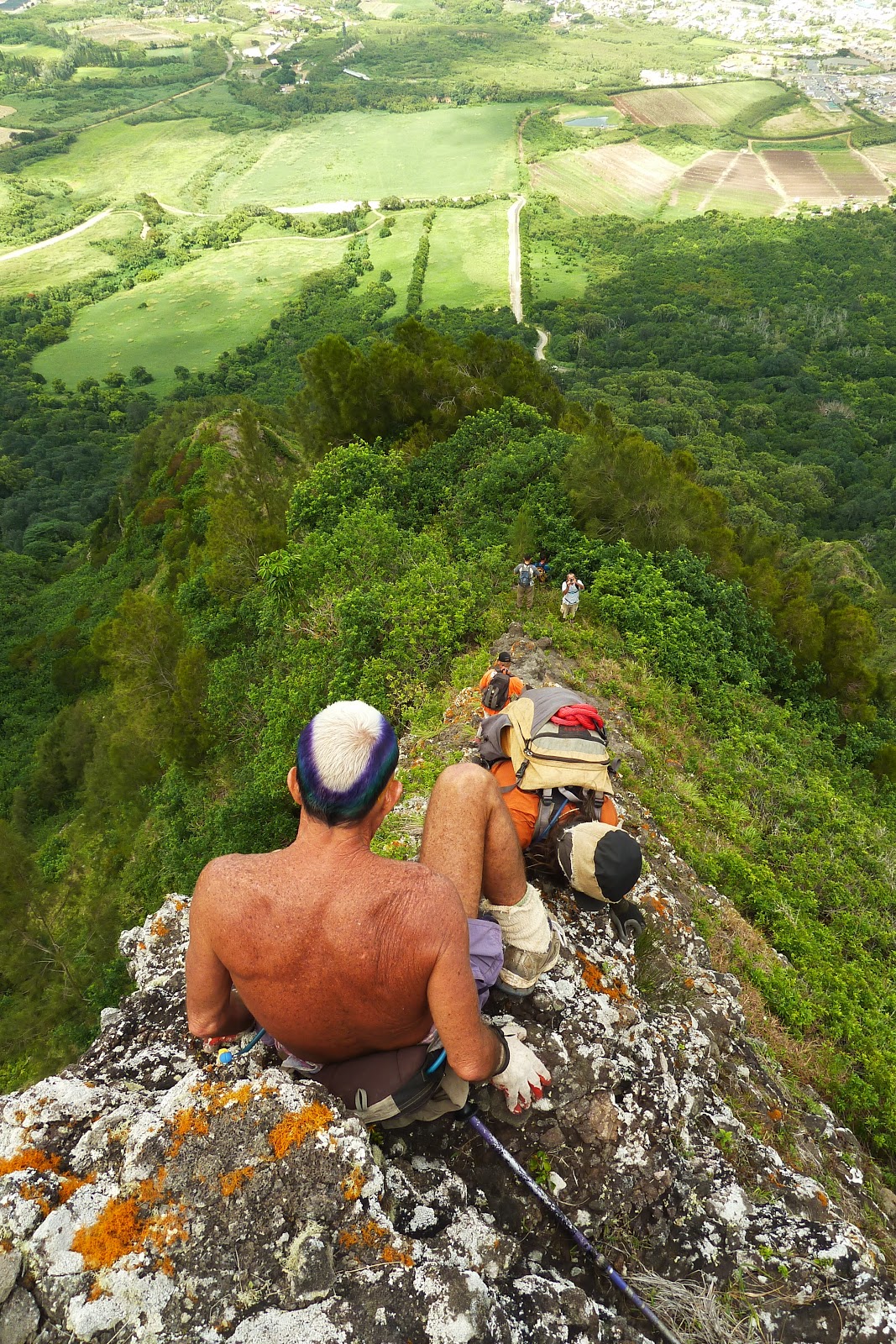
Up, up, up we went and looking ahead were some imposing rock faces.  Without warning I heard a thunderous sound as apparently someone far ahead (Marcus claims it was him) dislodged a massive boulder, sending it crashing down to my right.  This would be the theme for the remainder of the day, especially upon our descent down Hahaione Windward.  The climb was considerably steep, but the rockfaces were not too bad, except for one which I had a difficult time due to my camera rig which ultimately ended up smacking my GoPro (in it's housing) against the face everytime I bent forward.  During the climb, I heard a female hiker call out to me from far below, asking where the trail continues.  I called out to her in return and told her the directions.

After huffing my way through an Ironwood grove and more Koa Trees (more camera snags!), I could see that the top was already near.  It was here did I realize the female hiker (Thea) who called out earlier was climbing up ridge #4!  I took a quick glance back over to ridge #2 and could see the other group near the summit.  It was a pretty cool feeling to see hikers to my left and right, and that we were using 3 ridges simultaneously!  Gene and I were joking around, saying that we should place doors at the bottom of all 3 ridges and play what's behind door #2, #3, and #4?!

I made it to the Ko'olau summit ridge and rejoined with the others for a well deserved break.  Pressing on westward, we hiked over towards the great white pole of Tom-Tom, passing by the terminal point of Kamiloiki Ridge in just 5 minutes.  I was surprised by the sheer number of hikers on this day.  By my count, there had to be at least over 20 hikers all lined up nicely in single file.  I chatted with the hiker in front and behind me as we made our way over.  I took advantage of the open ridgeline and extended the monopod to it's farthest position.  Josh joked that he was trying to look for a remote control because the monopod made me look like I was some kind of "r/c hiker"!

Upon reaching Tom-Tom, we took another break and the group broke off to descend the Tom-Tom Trail to conclude their hike while the rest of us pressed on towards Mariner's Ridge.  At this point, I also decided to put away the monopod as I did not want another repeat of camera snagging during our descent.  We reached Mariner's and we began scanning the windward ridges west of here.  Pete has descended two windward ridges, Mariner's Windward, and possibly Mariner's West Windward in the past.  However, he did not descend Hahaione Windward yet so this was the ridge to descend today.

The initial descent was already steep and overgrown.  By the time the foliage opened up a bit, the ridge narrowed considerably and got steeper.  On a narrow dike, we had to be careful because we could not see where our feet landed, making for a tricky descent.  Beyond the dike, everything crumbled under the slightest touch and we had to be wary of rock falls, especially with hikers in front.  We were about 3/4ths of the way down when the ridge suddenly ended a few hundred feet above the treelines of "flatland".  Pete and August busted out their ropes and one by one we went down a 60ft cliff face.  The face wasn't as bad as it looked from the top as foot and handholds were plentiful.

Once everyone made it down safely, we could not proceed downward anymore as more cliffs were present so Pete decided to contour to the right and down and at last we were off the ridge, still alive once more!  We began the anticlamatic jaunt along the base of the Ko'olaus back to the junction of Tom-Tom and back to our cars to conclude an exciting 8 hour journey!

It was a memorable hike with great company!


Video: